This is how I get the N number to determine which planes and companies are NOT flying the requested path.
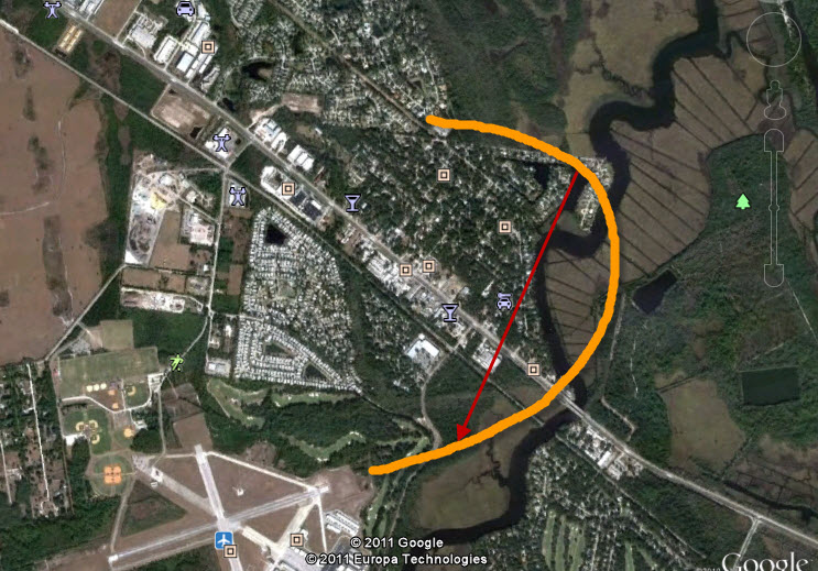
Below is a google earth image showing the airport and Tomoka Estates. I
usually take photos on the red arrow as the airplane leaves the airport on
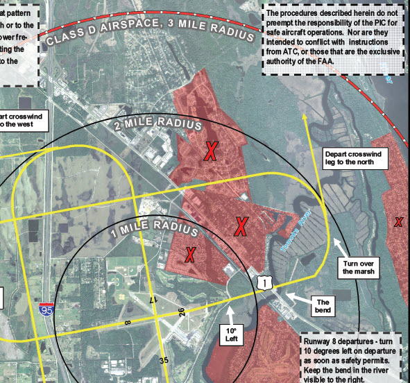
runway 26 going east. A example is in orange where a airplane starts out,
but never goes out over the path (second photo) the City has requested them to
fly on or near.
This is how I get the N number to determine which planes and companies are NOT
flying the requested path.